The Melbourne Causeway and the path to the beach
From Ernest Kouwen-Hoven's 1921 wooden toll bridge to the 1947 swing-draw replacement and the modern two-span concrete crossing, the Melbourne Causeway is how the mainland city reaches its beach. Here's the construction history.
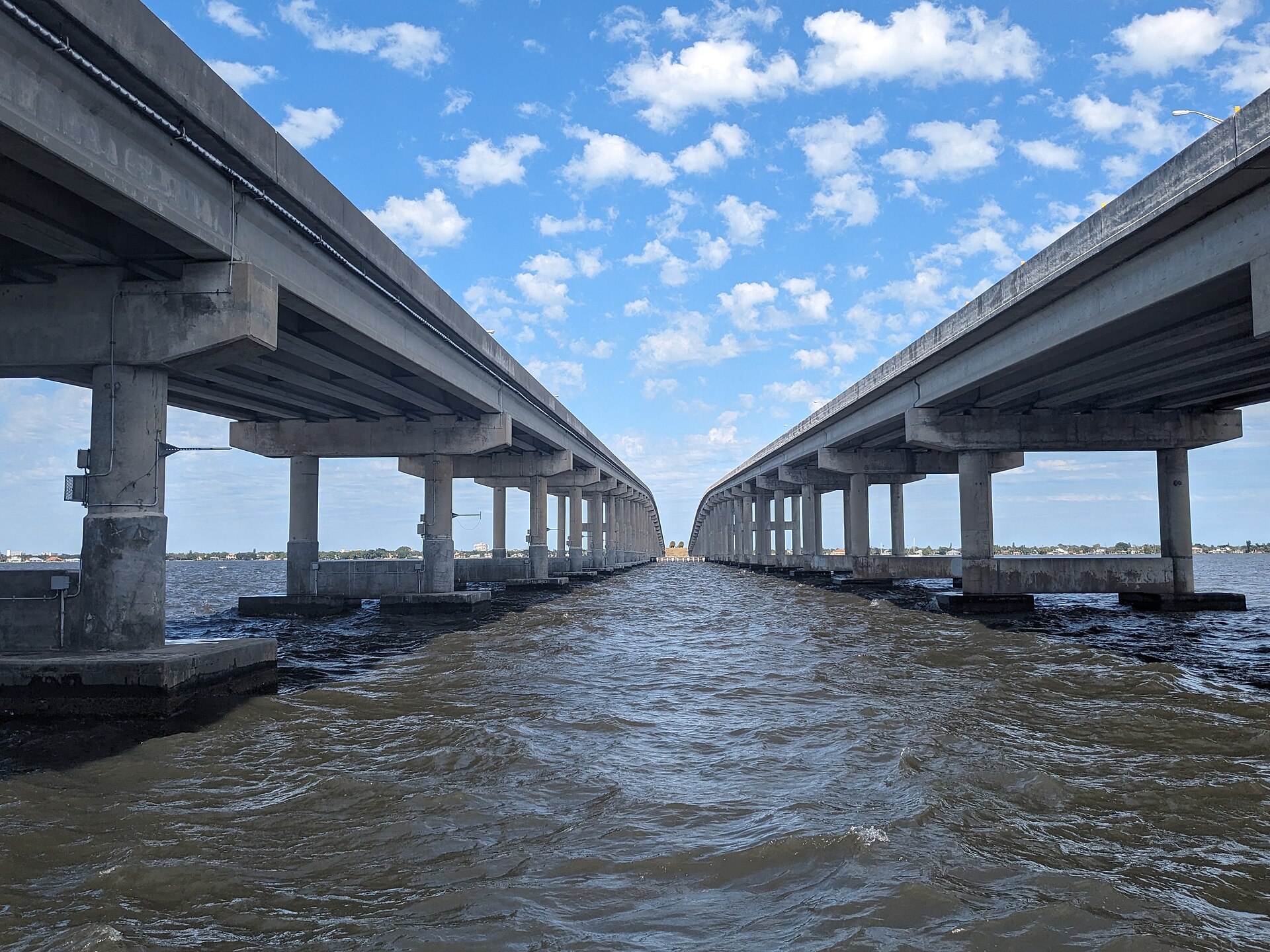
The Melbourne Causeway carries US-192 across roughly a mile and a half of Indian River Lagoon from the mainland city to the barrier island community of Indialantic. The current crossing has two parallel spans (eastbound and westbound) of post-tensioned concrete, opened in 1979 and 1984. Ernest Kouwen-Hoven’s original 1921 wooden toll bridge is long gone, and so is the 1947 swing-draw concrete replacement that succeeded it. The story of how the crossing evolved, in three generations, is also the story of how Melbourne’s relationship to its beach changed from a half-hour boat trip to a ten-minute drive.
Before the causeway
Before the first causeway opened the Melbourne beach was effectively unreachable by anyone without a boat. The Indian River Lagoon at Melbourne is about 7,500 feet wide. A working boat could cross it in twenty minutes; a rowboat in forty-five. A horse and carriage couldn’t cross it at all. Beachgoers from Melbourne who didn’t own a boat hired one.
There were a few small private boat operations running passengers across in the late 1910s, but the volumes were tiny. The barrier island settlements (Melbourne Beach, Indialantic, then very small) developed slowly because of the access problem.
A causeway proposal had been floated since the early 1910s. The reason it didn’t happen earlier: cost. A 7,500-foot causeway over salt water, even using cheap pile-and-plank construction, was a serious municipal investment for a city of fewer than 2,000 people. The cost-benefit math only worked once tourism started suggesting that Melbourne could capture a meaningful share of the 1920s Florida land boom.
The 1921 Kouwen-Hoven bridge
The first causeway was the work of one developer. Ernest Kouwen-Hoven, a Belgian-American real estate man with holdings on the barrier island, financed and built it as a private toll bridge. Construction finished in 1921 and the bridge officially opened on September 18, 1921. (A 1925 date that floats around local writeups appears to confuse the opening with a later improvement; the contemporary record is 1921.)
The original crossing was 9,706 feet long, just under two miles, with a 134-foot hand-operated draw section roughly a third of the way out from the mainland. Construction was pile-and-plank on creosoted pine pilings, with the draw on a central pivot turned by a deckhand with a hand crank. Tolls were collected at a small wooden gatehouse on the mainland end. The Kouwen-Hoven family operated the crossing privately for more than two decades.
The economic effect was immediate. Lots in Indialantic and Melbourne Beach that had moved infrequently in the 1910s began to trade. The 1925 Sanborn map of Melbourne shows a beachfront sales office on Front Street that had not existed five years earlier. The 1920s Florida land boom never reached the speculative pitch of Miami or Sarasota in Brevard, but the causeway is what let it reach Melbourne at all.
What the causeway changed
Real estate on the barrier island. Before 1925, beach lots in Melbourne Beach and Indialantic were worth almost nothing. After 1925 they appreciated steadily. After 1957 they appreciated faster. After 1983 (when the modern spans started arriving) they entered the high-end Florida coastal market. A 2026 buyer of a beachfront lot in Melbourne Beach is paying for a hundred years of accumulated causeway access.
The economic geography of US-192. The causeway anchors the eastern end of US-192, a corridor that runs west all the way to Orlando and Disney World. The economic significance of US-192 as a tourist artery depends on the causeway being open. Closures (hurricane evacuations, accidents, occasional maintenance) immediately compress the entire corridor’s traffic.
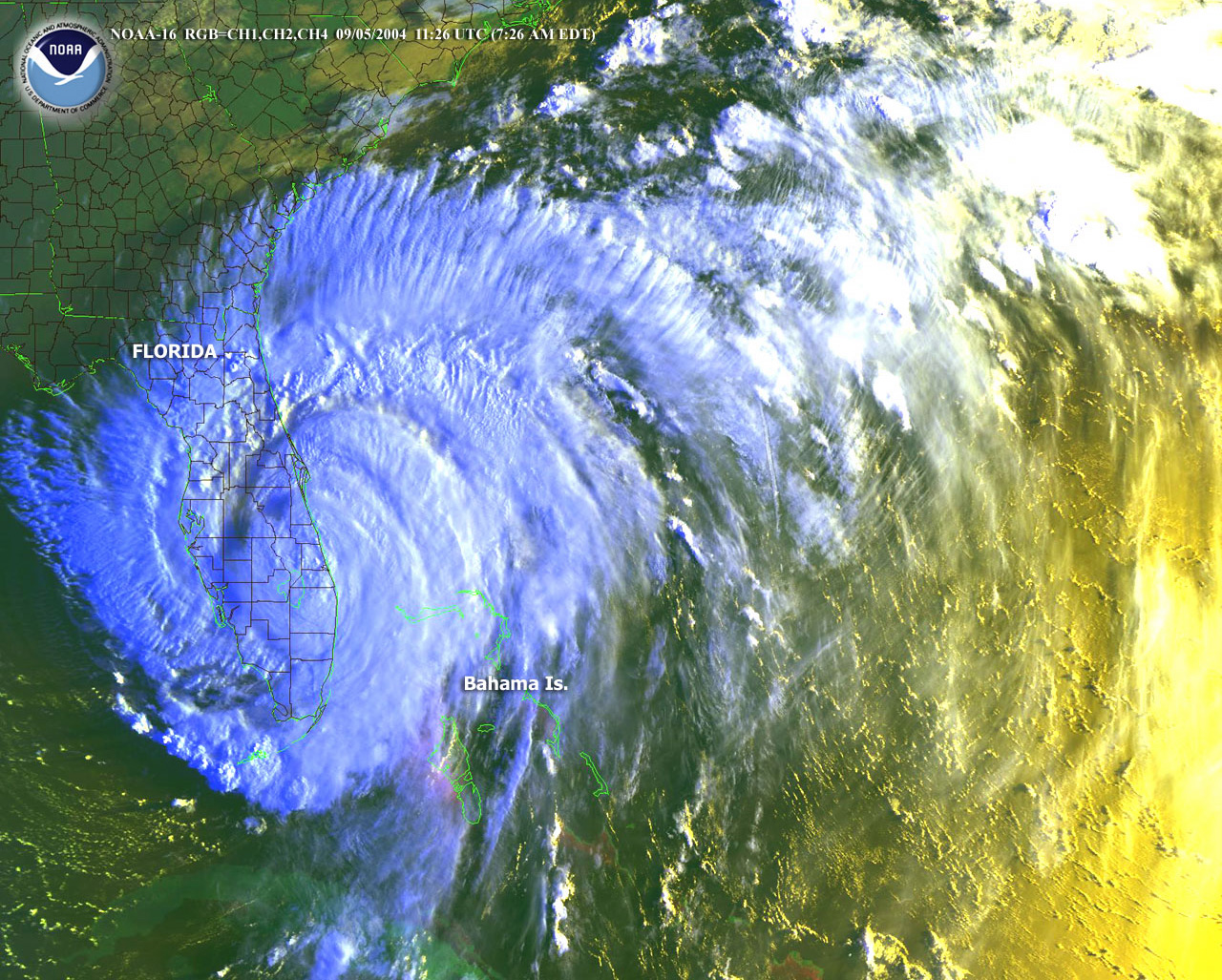
Hurricane evacuation patterns. The causeway is the only road off the south Brevard barrier island. In a major hurricane (Frances 2004, Jeanne 2004, Matthew 2016, Irma 2017), the causeway becomes the evacuation chokepoint for tens of thousands of barrier-island residents. State and county planners have spent decades trying to figure out how to widen the throughput. The two-span configuration helps but doesn’t eliminate the bottleneck.
Beachgoer traffic. On a busy summer Saturday the causeway carries 35,000 to 50,000 vehicles. A weekday off-season carries about 22,000 to 28,000. That’s a significant load for any bridge, and the maintenance demands on the spans reflect it.
The Eau Gallie Causeway, briefly
Worth noting: the Melbourne Causeway is not the same crossing as the Eau Gallie Causeway, which is a separate state-road causeway about three miles north (SR-518 / Eau Gallie Boulevard). The Eau Gallie Causeway opened in 1955 to serve what was then the city of Eau Gallie. The two crossings together carry essentially all the road traffic between mainland Melbourne (post-merger) and the barrier-island communities of Indialantic and Indian Harbour Beach.
A third crossing, the Pineda Causeway (SR-404), opened in 1971 connecting Suntree/Viera area to Patrick Air Force Base on the barrier island. The Pineda is the newest causeway in south Brevard.
The 1947 swing-draw replacement
By the early 1940s the original 1921 timber bridge was past usable life. The pilings had rotted, the planking sagged, and the hand-cranked draw could no longer keep pace with boat traffic. Construction on a replacement began in 1941, then slowed during the war as Florida bridge crews were diverted to military work. The new low-rise swing-draw bridge finally opened on August 1, 1947. Mrs. Ernest Kouwen-Hoven cut the ribbon, and the same J. E. Campbell who had crossed the first bridge in 1921 was the first across the second.
The 1947 bridge was a more serious piece of engineering: a low concrete-and-steel structure with a motorized swing-draw section in the navigable channel near the middle of the lagoon. Tolls continued under a Brevard County operating arrangement for a number of years before the crossing went toll-free. The 1947 bridge carried all the eastbound and westbound traffic on a single two-lane deck for the next three decades.
The 1979 and 1984 twin spans
By the mid-1970s the single 1947 deck was the chokepoint on the entire south Brevard road network. Florida DOT planning for a replacement began in 1972; right-of-way acquisition and design ran through 1976. The first new span, the westbound crossing, opened in 1979. The second, the eastbound, followed in 1984. Both are post-tensioned concrete with fixed high-rise navigation clearance, eliminating the draw and the boat-traffic delays that had defined the older bridges.
The configuration of two parallel high-rise spans rather than one wider replacement was a deliberate redundancy choice. With two structures, a major maintenance event or a serious accident on one span does not close the corridor entirely. Hurricane post-storm inspection can also be staggered: one deck reopens while the other is still being walked. The trade-off is double the long-term inspection and resurfacing cost, which FDOT has accepted as worth the resilience.
What’s planned
FDOT has no scheduled replacement for the Melbourne Causeway in the current six-year plan. The current spans are middle-aged (the eastbound is 35 years old, the westbound 41) but well within design life. Realistically, planning for the next replacement starts in the 2030s, with construction perhaps in the 2040s.
Climate adaptation is the next major variable. Florida’s sea-level rise projections (FDOT uses the NOAA Intermediate-High scenario in current planning) put the causeway’s bridge deck more than two feet above projected high water through 2070, so the spans themselves are well above the line. The approach causeways at each end, lower, are the vulnerability. Future replacements will likely raise both approach causeways significantly.
Sources
- Florida Department of Transportation, bridge inventory and inspection records for the Melbourne Causeway, accessed 2026-01-12. https://www.fdot.gov/
- Florida Memory Project, Brevard County roads and bridges photographs, accessed 2026-01-12. https://www.floridamemory.com/
- City of Melbourne historical records on the 1925 causeway funding, accessed 2026-01-12. https://www.melbourneflorida.org/
- US Geological Survey, historical aerial photography of Brevard County, accessed 2026-01-12.
- NOAA sea level rise scenario datasets used in FDOT planning, accessed 2026-01-12.
- “Melbourne Causeway,” Wikipedia, citing contemporary Florida East Coast Railway and Brevard County records on the Kouwen-Hoven bridge (1921), the 1947 swing-draw replacement, and the 1979 / 1984 twin-span construction dates. https://en.wikipedia.org/wiki/Melbourne_Causeway
Further Reading
As an Amazon Associate we earn from qualifying purchases.